| mdNavMobile 1.4 build 3921 (2010-09-26) |  |
|
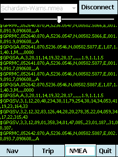
mdNavMobile is a waypoint-based GPS navigation solution for the Windows Mobile platform. It can guide you from waypoint to waypoint while keeping you informed of all relevant navigation data. All NMEA-data from a GPS is automatically logged to file so you can 'replay' a trip with variable speed. |
| mdNavMobile Features |
|
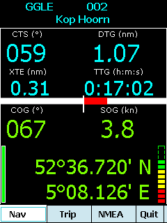
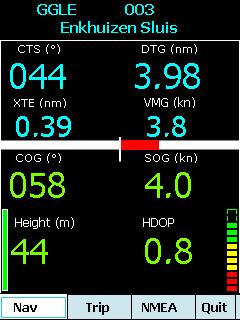
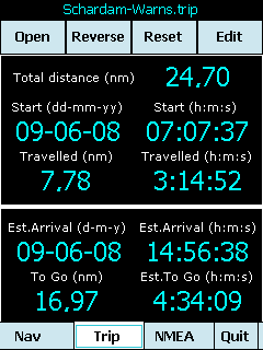
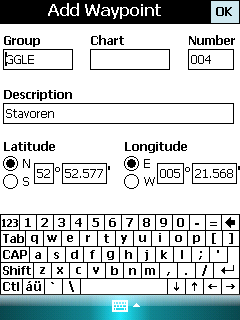
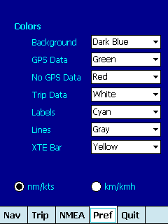
- GPS info: Latitude, Longitude, COG, SOG, Height, Satelites, HDOP and NMEA-stream - Waypoint info: CTS, DTG, TTG, VMG, XTE - Trip info: Total distance, Start, Travelled distance/time, DTG, TTG, ETA - Reverse and Reset trips - Scroll to next/previous waypoint - Logs full NMEA stream from GPS to Storage Card - Simulation using NMEA-log files with variable speed (factor 0.01-100) - Create/Edit Trips and Waypoints - Show data in nm/kts/ft or km/kmh/m - Change colors - Trip-files also editable with notepad - Totally free |
 |  |  |  |
 |  |  |  |
mdNavMobile is tested on Windows Mobile 5 and 6 Classic/Professional with touchscreen |
| Download mdNavMobile CAB installer |
| (mdNavMobile needs Microsoft .Net Compact Framework 3.5 ) |
| Several HTC owners have reported trouble connecting the GPS while others have it working. An extra utility GpsGate seems to make it work on most HTC's If you have it working on a HTC, please send me an email with the settings used, so that I can help other HTC owners getting it to work. |
| Download mdNmea2Kml if you want to view your trip in Google Earth |
| Download mdKml2Trip to create trips with Google Earth placemarks |
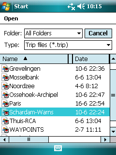
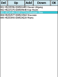
| Trip definitions are also editable with any text-editor. The first line is a free format trip description Waypoint lines have the following format: group,chart,nr,latitude,longitude,description Strict formatting for Latitude: NDDMM.mmmm and Longitude: EDDDMM.mmmm All other fields are free format or can be left blank |
|
Schardam-Warns (9 juni 2008) IJMR,,001,N5235.996,E00501.455,Haven Uitgang IJMR,,002,N5237.275,E00509.640,Kop Hoorn IJMR,,003,N5241.406,E00517.724,Enkhuizen Sluis IJMR,,004,N5252.577,E00521.568,Stavoren IJMR,,005,N5253.093,E00524.228,Warns |